banner

.

Digital Reference Shelf for Earth Science


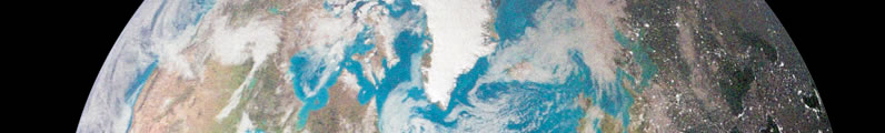
The Digital Reference Shelf for Earth Science (DRSES) is a constantly evolving collection of media that includes web-based simulations, information files, and digital atlases designed for earth science education. Much of the media contained in the DRSES is copyrighted by Artemis Science (my company). If you have questions or comments about any of these resources email me (Frank Granshaw) at < fgransha@pdx.edu >

Directory


Simulators and Atlases

GeoCycle - An interactive simulation of the geologic cycle. This program is currently under construction. This means that while it basically functional for many of the activities we do in lab and lecture, it is constantly being updated.

GeoTimePacific Northwest - An interactive atlas of the Pacific Northwest showing changes in the regions geography and major geologic events over the past 600 million years. This program aslo contains an interactive geologic atlas that allows you to explore the evidence for the paleogeographic sequence. A paleogeographic sequence is a collection of maps showing changing in geography over long periods of times.

GeoTime - An interactive geologic calendar and paleogeographic atlas. Like GeoCycle, this program is functional, but under construction.

GeoAtlas - An interactive world atlas. Like GeoCycle, this program is functional, but under construction.

Virtual Field Environments

Virtual Northwest - An evolving collection of virtual field sites for locations throughout the Pacific Northwest.

TOTLE in the Field - An on-line tool used in field trip orientations for Teachers on the Leading Edge (an NSF funded teachers workshop focusing on the geology and Geophysics of the Northwest.


Discussion Activity Media

Activites for Geology of the Pacific Northwest

Activites for Physical and Historical Geology

Activites for Historical Geology

Activites for Environmental Geology

Activites for Meteorology

Activites for Oceanography


Lab Activities with significant On-line Components

General Science - Geology

General Science - Oceanography

General Science - Meteorology

Urban based field labs

Misc. Geology labs


Links for downloading Google Earth and other virtual globes


  • Google Earth - Google's geographic data browser. Works on both MacOS and windows computers.
  • World Wind - A geographic data browser from NASA. Only works on machines running windows. This link is to the download page for the World Wind website. Make sure to read about the system requirements before you load it.
  • GeoWind - A java based geospatial viewer based on World Wind. In addition to many of the same features as Google Earth and World Wind, GE features 3-D viewing, a terrain profiler, and the ability to choose air photos and satellite images from a variety of government sources.
  • Virtual Ocean - Another java based geospatial viewer. Also based on World Wind. This one is a lot like GeoWind but has far more imagery that you can overlay on the globe (e.g. geologic maps, links to deep sea photos, etc.). Warning this extra capability comes at a price. It is more complicated to use.

Page created September 18, 2012 / Revised April 16,2015

.